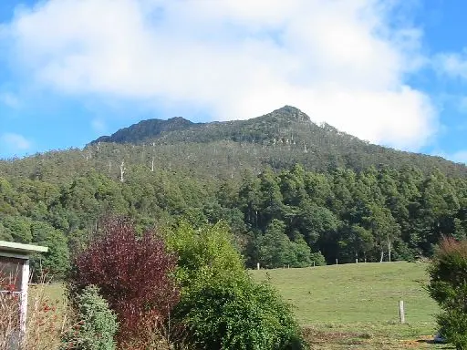
Meander Conservation Area
Meander Conservation Area is a national park about 11 km from Meander, Tasmania. It is managed by Tasmania Parks & Wildlife Service. Location data © OpenStreetMap contributors, available under the ODbL.
AustraliaWeb: Your Guide to Accessible & Family Travel in Australia
Meander Conservation Area is a national park about 11 km from Meander, Tasmania. It is managed by Tasmania Parks & Wildlife Service. Location data © OpenStreetMap contributors, available under the ODbL.
Quamby Bluff Conservation Area is a nature reserve about 8 km from Meander, Tasmania. It is managed by Tasmania Parks & Wildlife Service. Location data © OpenStreetMap contributors, available under the ODbL.
Liffey Conservation Area is a national park about 13 km from Meander, Tasmania. It is managed by Tasmania Parks & Wildlife Service. Location data © OpenStreetMap contributors, available under the ODbL.
Scotts Road Lookout is a lookout about 5 km from Meander, Tasmania. View is from the side of the road, of Quamby Bluff and Meander Valley. As of 8th June 2019, a sign in the area said "Welcome to the Scotts Road Lookout, maintained by the Meander Resource Management Group". It rises to about 850 … Read more
Projection Bluff Lookout is a lookout about 12 km from Meander, Tasmania. This is a wooden platform with views of Projection Bluff and Liffey Bluff. Location data © OpenStreetMap contributors, available under the ODbL.
Shower Cave Falls is a waterfall about 10 km from Meander, Tasmania. Location data © OpenStreetMap contributors, available under the ODbL.
Cleft Rock Falls is a waterfall about 11 km from Meander, Tasmania. Location data © OpenStreetMap contributors, available under the ODbL.
Lower Chasm Falls is a lookout about 8 km from Meander, Tasmania. Location data © OpenStreetMap contributors, available under the ODbL.
Warners Sugarloaf is a mountain & peak about 5 km from Meander, Tasmania. It rises to about 790 m above sea level. Location data © OpenStreetMap contributors, available under the ODbL.
Archers Sugarloaf is a mountain & peak about 3 km from Meander, Tasmania. Location data © OpenStreetMap contributors, available under the ODbL.