Mount Hay
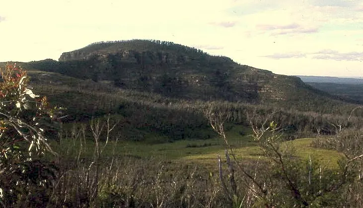
Mount Hay is a mountain & peak about 11 km from Wentworth Falls, New South Wales. It rises to about 944 m above sea level. Location data © OpenStreetMap contributors, available under the ODbL.
AustraliaWeb: Your Guide to Accessible & Family Travel in Australia
Mount Hay is a mountain & peak about 11 km from Wentworth Falls, New South Wales. It rises to about 944 m above sea level. Location data © OpenStreetMap contributors, available under the ODbL.
Wirrimbirra Flora & Fauna Sanctuary is a zoo & wildlife about 3 km from Bargo, New South Wales. Listed opening hours: Tu-Su 09:00-16:30. Location data © OpenStreetMap contributors, available under the ODbL.
Lambies Well is a lookout near Berrima, New South Wales. Location data © OpenStreetMap contributors, available under the ODbL.
Illawarra Lookout is a lookout about 1 km from Barren Grounds, New South Wales. Location data © OpenStreetMap contributors, available under the ODbL.
The Convicts Vista is a lookout about 1 km from Castle Hill, New South Wales. Location data © OpenStreetMap contributors, available under the ODbL.
Old Rotary lookout is a lookout about 2 km from Kandos, New South Wales. Location data © OpenStreetMap contributors, available under the ODbL.
Who'd A Though It Lookout is a lookout about 2 km from Quirindi, New South Wales. Location data © OpenStreetMap contributors, available under the ODbL.
Red Hands Cave is a historic site about 4 km from Blaxland, New South Wales. Location data © OpenStreetMap contributors, available under the ODbL.
Angullong Vineyard is an attraction about 22 km from Canowindra, New South Wales. Location data © OpenStreetMap contributors, available under the ODbL.
Darcys Lookout is a lookout about 1 km from Gillieston Heights, New South Wales. Location data © OpenStreetMap contributors, available under the ODbL.