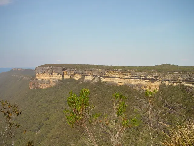
Kalang Falls
Kalang Falls is a waterfall about 20 km from Jenolan Caves, New South Wales. Location data © OpenStreetMap contributors, available under the ODbL.
AustraliaWeb: Your Guide to Accessible & Family Travel in Australia
Kalang Falls is a waterfall about 20 km from Jenolan Caves, New South Wales. Location data © OpenStreetMap contributors, available under the ODbL.
Kanangra-Boyd National Park is a national park about 13 km from Jenolan Caves, New South Wales. It is managed by NSW National Parks and Wildlife Service. Official website Location data © OpenStreetMap contributors, available under the ODbL.
Grand Arch is an attraction near Jenolan Caves, New South Wales. Location data © OpenStreetMap contributors, available under the ODbL.
Baldy Harry is a mountain & peak about 15 km from Jenolan Caves, New South Wales. Location data © OpenStreetMap contributors, available under the ODbL.
Big Misty is a mountain & peak about 19 km from Jenolan Caves, New South Wales. It rises to about 1183 m above sea level. Location data © OpenStreetMap contributors, available under the ODbL.
Morong Falls Lookout is a lookout about 18 km from Jenolan Caves, New South Wales. Location data © OpenStreetMap contributors, available under the ODbL.
Gentles Lookout is a lookout about 19 km from Jenolan Caves, New South Wales. Location data © OpenStreetMap contributors, available under the ODbL.
Gillespies Lookout is a lookout about 15 km from Jenolan Caves, New South Wales. Not a signposted lookout. Difficult to find. Location data © OpenStreetMap contributors, available under the ODbL.
Cockerills Lookout is a lookout about 25 km from Jenolan Caves, New South Wales. Location data © OpenStreetMap contributors, available under the ODbL.
The Old Post Office is a museum & gallery near Jenolan Caves, New South Wales. Location data © OpenStreetMap contributors, available under the ODbL.