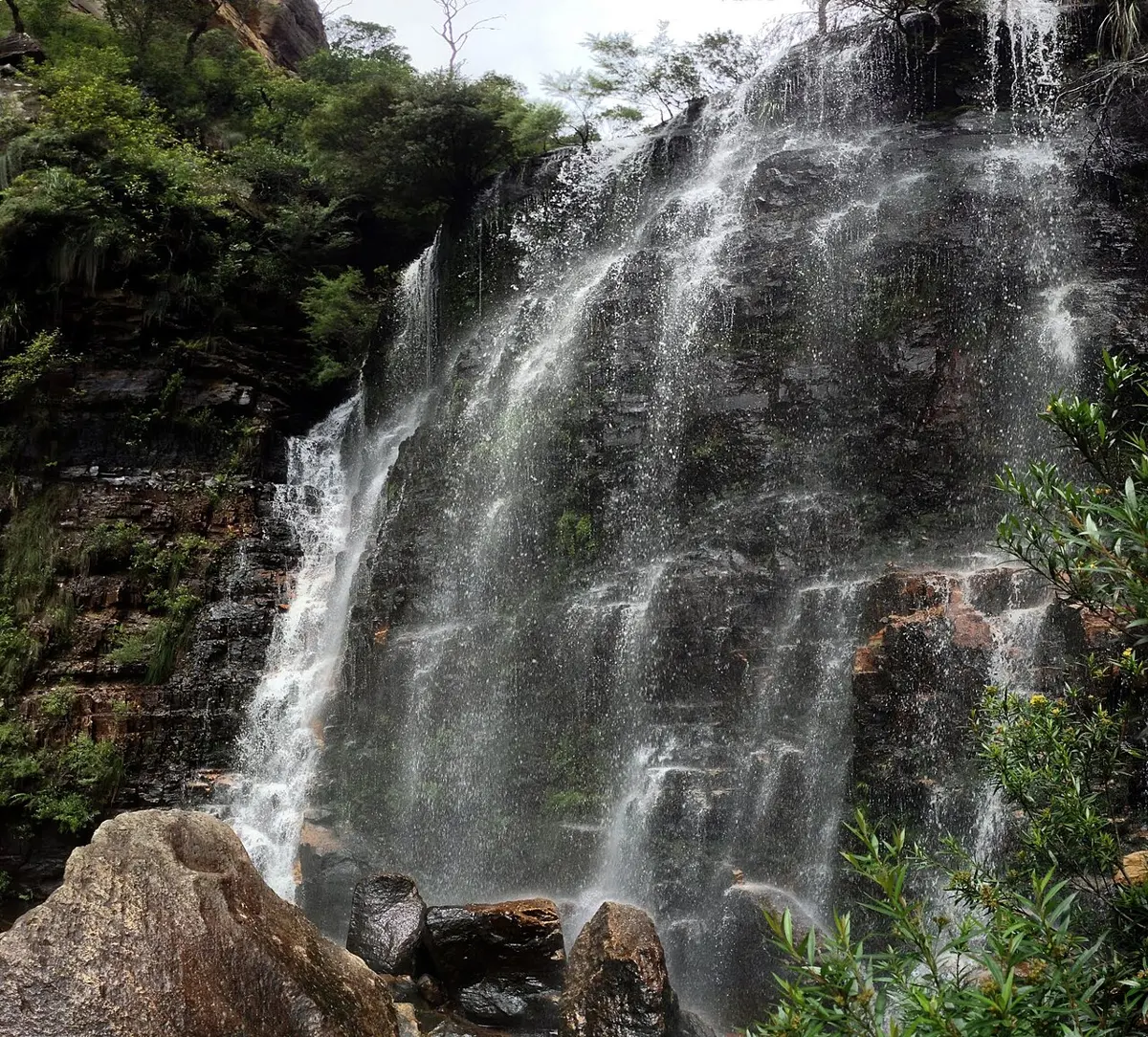
Upper Gledhill Falls
Upper Gledhill Falls is a waterfall about 2 km from Akuna Bay, New South Wales. Location data © OpenStreetMap contributors, available under the ODbL.
Discover Australia and the world: lookouts, waterfalls, beaches and local guides
Upper Gledhill Falls is a waterfall about 2 km from Akuna Bay, New South Wales. Location data © OpenStreetMap contributors, available under the ODbL.
Dalwood Falls is a waterfall about 6 km from Alstonville, New South Wales. Location data © OpenStreetMap contributors, available under the ODbL.
Marom Creek Falls is a waterfall about 6 km from Alstonville, New South Wales. Location data © OpenStreetMap contributors, available under the ODbL.
Marshalls Falls is a waterfall about 2 km from Alstonville, New South Wales. Location data © OpenStreetMap contributors, available under the ODbL.
Appin Falls is a waterfall about 6 km from Appin, New South Wales. Location data © OpenStreetMap contributors, available under the ODbL.
Dangars Falls is a waterfall about 19 km from Armidale, New South Wales. Location data © OpenStreetMap contributors, available under the ODbL.
Mihi Falls is a waterfall about 21 km from Armidale, New South Wales. Location data © OpenStreetMap contributors, available under the ODbL.
Eight Mile Falls is a waterfall about 24 km from Ashford, New South Wales. Location data © OpenStreetMap contributors, available under the ODbL.
Macintyre Falls is a waterfall about 23 km from Ashford, New South Wales. Location data © OpenStreetMap contributors, available under the ODbL.
Severn River Falls is a waterfall about 23 km from Ashford, New South Wales. Location data © OpenStreetMap contributors, available under the ODbL.
Lower Minnamurra Falls is a waterfall about 5 km from Barren Grounds, New South Wales. Location data © OpenStreetMap contributors, available under the ODbL.
Lyrebird Falls is a waterfall about 5 km from Barren Grounds, New South Wales. Location data © OpenStreetMap contributors, available under the ODbL.
Upper Minnamurra Falls is a waterfall about 5 km from Barren Grounds, New South Wales. Location data © OpenStreetMap contributors, available under the ODbL.
Wonga Falls is a waterfall near Barren Grounds, New South Wales. Location data © OpenStreetMap contributors, available under the ODbL.
Mumbulla Creek Falls is a waterfall about 12 km from Bega, New South Wales. Location data © OpenStreetMap contributors, available under the ODbL.
Barracks Falls is a waterfall about 15 km from Berrima, New South Wales. Location data © OpenStreetMap contributors, available under the ODbL.
Waratah Falls (Unofficial name) is a waterfall about 7 km from Bilpin, New South Wales. Location data © OpenStreetMap contributors, available under the ODbL.
Bora Falls is a waterfall about 9 km from Bingara, New South Wales. Location data © OpenStreetMap contributors, available under the ODbL.
Arethusa Falls is a waterfall about 7 km from Blackheath, New South Wales. Location data © OpenStreetMap contributors, available under the ODbL.
Beauchamp Falls is a waterfall about 5 km from Blackheath, New South Wales. Location data © OpenStreetMap contributors, available under the ODbL.
Centennial Falls is a waterfall near Blackheath, New South Wales. Location data © OpenStreetMap contributors, available under the ODbL.
Centennial Glen Waterfall is a waterfall about 1 km from Blackheath, New South Wales. Location data © OpenStreetMap contributors, available under the ODbL.
Crayfish Falls is a waterfall about 6 km from Blackheath, New South Wales. Location data © OpenStreetMap contributors, available under the ODbL.
Edenderry Falls is a waterfall about 6 km from Blackheath, New South Wales. Location data © OpenStreetMap contributors, available under the ODbL.
Fortress Falls is a waterfall about 6 km from Blackheath, New South Wales. Location data © OpenStreetMap contributors, available under the ODbL.
Gossamer Falls is a waterfall about 4 km from Blackheath, New South Wales. Location data © OpenStreetMap contributors, available under the ODbL.
Govetts Leap Falls is a waterfall about 3 km from Blackheath, New South Wales. Location data © OpenStreetMap contributors, available under the ODbL.
Hat Hill Falls is a waterfall about 6 km from Blackheath, New South Wales. Location data © OpenStreetMap contributors, available under the ODbL.
Hilary Falls is a waterfall about 6 km from Blackheath, New South Wales. Location data © OpenStreetMap contributors, available under the ODbL.
Horseshoe Falls is a waterfall about 3 km from Blackheath, New South Wales. Location data © OpenStreetMap contributors, available under the ODbL.