Stuart Highway
Stuart Highway — Adelaide to Darwin Outback Drive
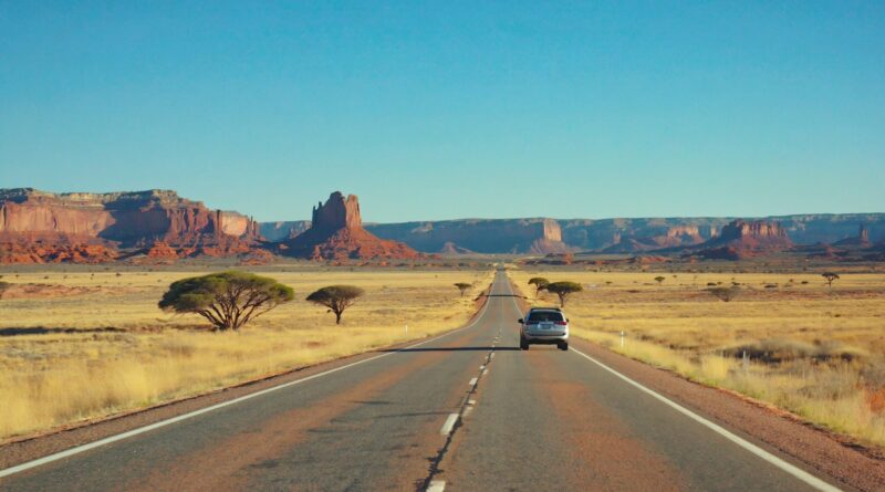
The legendary north–south backbone of Australia, linking Adelaide to Darwin through dramatic outback, desert opals, red‑centre icons, tropical gorges, and Top End wetlands. Plan safe distances, fuel, rest stops, and highlights below.
Routes A–Z ·
Outback Trips ·
Toilet Finder ·
Near Me
At a glance
- Distance: ~3,000 km Adelaide ↔ Darwin
- Time: 7–10 days (minimum 4–5 days direct with long driving)
- Road type: Sealed highway; remote stretches with long distances between towns
- Best months: Apr–Sep (cooler south; dry season in the north). Oct–Mar brings Top End storms/heat.
- Ideal for: Big road trips, outback scenery, star gazing, national parks, cultural experiences
Map overview (key segments)
Adelaide → Port Augusta → Woomera → Coober Pedy → Marla → NT Border → Uluru/Kata Tjuta detour (via Lasseter Hwy) → Erldunda → Alice Springs → Devils Marbles / Karlu Karlu → Tennant Creek → Elliott → Dunmarra → Katherine → Litchfield detour → Darwin.
Suggested itineraries
6–7 days (express with signature stops)
- Day 1: Adelaide → Port Augusta → Woomera (rocket range exhibits) → Overnight Coober Pedy (underground stays)
- Day 2: Coober Pedy → Marla → NT Border → Erldunda (roadhouse). Optional late detour start to Uluru region.
- Day 3: Erldunda → Uluru/Kata Tjuta (detour) or direct to Alice Springs; sunset lookouts.
- Day 4: Alice Springs → Ti Tree → Barrow Creek → Devils Marbles / Karlu Karlu → Tennant Creek
- Day 5: Tennant Creek → Elliott → Dunmarra → Mataranka (hot springs) → Katherine
- Day 6: Katherine Gorge (Nitmiluk) short walks/boat tour → Pine Creek → Litchfield detour → Darwin
9–10 days (includes Uluru, West MacDonnell, Litchfield)
- Days 1–2: Adelaide → Coober Pedy (underground town, Breakaways)
- Day 3: Coober Pedy → Erldunda → Yulara (Uluru sunset)
- Day 4: Uluru base walk / Kata Tjuta Valley of the Winds
- Days 5–6: Yulara → Alice Springs → West MacDonnell (Simpsons Gap, Standley Chasm, Ormiston Gorge)
- Day 7: Alice Springs → Devils Marbles → Tennant Creek
- Day 8: Tennant Creek → Mataranka hot springs → Katherine
- Days 9–10: Katherine Gorge → Litchfield National Park (waterfalls) → Darwin
Facilities and rest stops
- Use Near Me at roadhouses, town parks, and visitor centres for amenities.
- Accessible Toilets at many roadhouses and major parks; Adult Change in larger hubs (Alice Springs, Katherine, Darwin).
- Fuel/food: Frequent in towns/roadhouses but plan ahead — top up often and check hours for remote stops.
- Water: Carry extra drinking water; refill at towns/visitors centres where available.
Short walks and lookouts
- Coober Pedy: Underground church/museum; Kanku–Breakaways lookout (unsealed access in parts).
- Uluru & Kata Tjuta (detour): Base walk segments and lookouts; cultural centre.
- Alice Springs region: Simpsons Gap, Standley Chasm, Anzac Hill lookout.
- Devils Marbles / Karlu Karlu: Short loop trails among giant boulders; sunrise/sunset glow.
- Katherine: Nitmiluk Gorge lookout walks or boat cruises; Mataranka thermal pools boardwalks.
- Litchfield (detour): Magnetic termite mounds, Florence Falls, Wangi Falls precincts.
Accessibility
- Many town foreshore/park precincts offer sealed paths and accessible amenities; check Accessible Toilets.
- National parks often provide sealed carparks and accessible lookouts/boardwalks; verify gradients and surfaces at visitor centres.
- Top End sites can be seasonally impacted (wet season); confirm access and road conditions before travel.
Outback safety and driving tips
- Distances: Plan fuel and water; don’t rely on a single stop. Carry a spare tyre and tools.
- Fatigue: Rest every 2 hours — see Road Safety & Rest Breaks. Swap drivers where possible.
- Wildlife & stock: Extra caution at dawn/dusk; avoid night driving when possible.
- Heat & weather: Check forecasts; in the Top End, storms/flash flooding can close roads quickly.
- Connectivity: Limited mobile coverage between towns; tell someone your plan and expected arrivals.
Where to stay
- Coober Pedy: Underground motels, caravan parks.
- Alice Springs: Good base for West MacDonnell day trips.
- Tennant Creek / Katherine: Convenient staging towns.
- Darwin: Top End hub with markets, waterfront, and museums.
- Camping & Outdoors for holiday parks and national‑park campgrounds (book ahead in peak season).
When to go
- Apr–May: Cooler south, building dry season in the north — excellent conditions.
- Jun–Aug: Peak dry season up north; cool desert nights down south.
- Sep–Oct: Warming in the north; start early for walks.
- Nov–Mar: Hot in the Red Centre; Top End wet season brings storms/humidity — flexible planning required.
FAQs
Can I drive the Stuart Highway in a 2WD?
Yes. The highway is sealed. Some detours (lookouts, national park tracks) may be unsealed; check conditions and drive cautiously.
How often are fuel stops?
Major towns/roadhouses appear every 100–250 km in many stretches. Still, top up frequently and verify hours, especially after dark.
Is it safe to drive at night?
Not recommended due to wildlife and stock on the road. Plan to arrive before dusk where possible.
Do I need permits or park passes?
Some national parks and Aboriginal lands require passes or fees; check official park pages from the Locations hub before detours.
Related pages